Island Lagoon
Designation:
Australia-SA_Island_Lagoon
Location:
| Latitude | Longitude |
|---|---|
-31.329661° | 136.479299° |
Locality and ownership:
Commonwealth Land (Nurrunga Restricted Area). The area is likely to be de-registered in the near future. Structures on the Nurrungar base may be kept for their historical associations. Surrounding land is Arcoona Station, SA Pastoral Lease L2347.
Access:
Requires Woomera Range Permit. 2 locked gates (for key and permit contact Bruce Henderson). From Woomera turnoff go 5km SE to Nurrungar Access road. 10km and through gates to plateau top.
Local contacts:
Bruce Henderson
Nearest services:
Coober Pedy.
Risks:
Lake surface boggy when wet; some slopes are steep. It is not safe to take vehicles onto the lake surface.
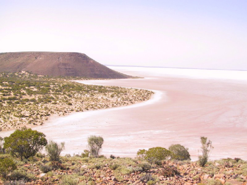
Terrain:
plateaus, sand dunes, lake bed
Site descriptions:
- The plateau level conisists of a pebble and cobble pavement overlying a soft reddish brown sand with a little clay. The pavement is mainly single-layer thick. These consist of sub-rounded, silicified sandstone, conglomerate and other hard lithologies.
- Slope down towards the dry lake bed. (grade) consisted of scree derived from the plateau, in places slightly gullied creating a boulder stream. The underlying bedrock is expose d in serveral places. It consists of horizonatally-bedded silt stones, and find sandstones. Groundwater seeps out in places and disrupts this bedrock with a salty efflorescence. These more weathered zones have been subjected to significant erosion.
- The lake floor, near the shoreline, consists of damp, salty sand and silt, scoured by recent channel outflows from recent floods. Clay has accummulated in the scours and on drying has curled and cracked. A darker layer of sediment suggests bacterial activity.
- Sand dunes inshore from the lakes edge consist of fine and medium quartz sands blown into an irregular topography.
Images:
Climate:
Nearest BOM Weather Station: Alice Springs
Flora and fauna:
Saltbush, pigface and bluebush are abundant either side of the access road. Scattered vegetation is present the plateau, the slope and the dunes. NB evaluation was made shortly following an extremely wet winter, so might be more abundant than usual. Grey kangaroos, emus abundant. Sheep droppings sighted. Budgerigars were seen.
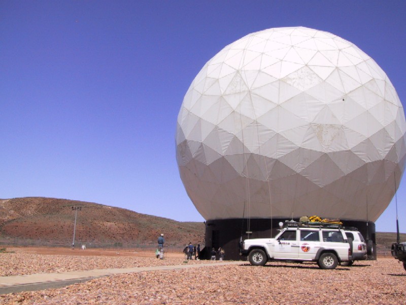
History:
Nurrunga base was closed in October, 1999. The dome has been abandoned and stripped of much of its equipment. Buildings inside the secure area are in good condition.
Analogue value:
There are at least five topographic elements: the plateau; the slopes; the dry lake bed; the dune fields and alluvial streams. The importance of this from a scientific viewpoint is the large range of sites of both geological and biological interest. From the standpoint of operations research, a complex range of environments and features within which you can and must operate. That range of complex terrains and forms will span the possible range of operations in a real surface mission. At the same time, the were no negative aspects of the site, which might have compromised suitability . In summary the site is rated high in analog value.
References:
- van Oosterzee, P. A 2000. Field Guide to Central Australia. Marleston, SA: J.B. Books.
Geology
Help the MSA!
This week @ NASA