Main menu
Climate
Climate Overview
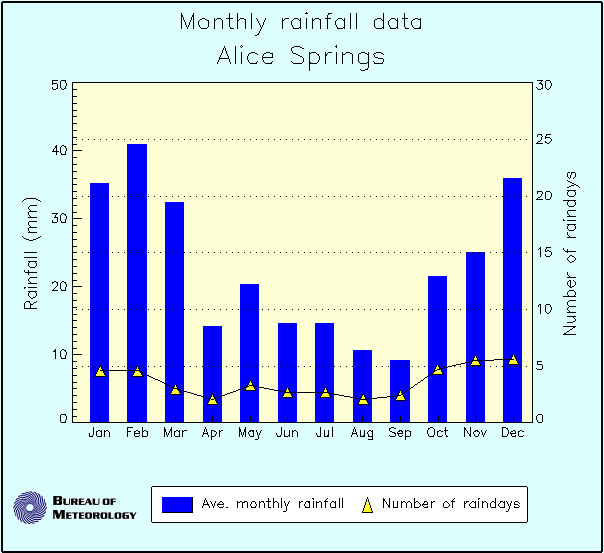
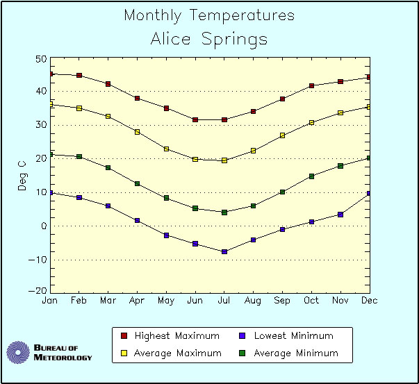
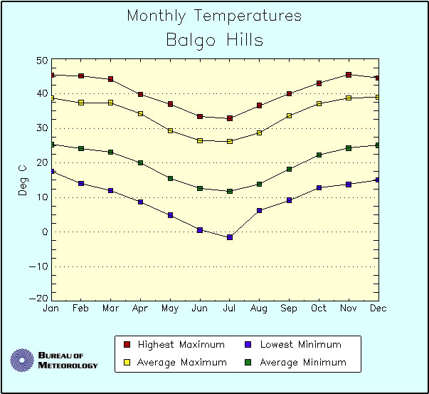
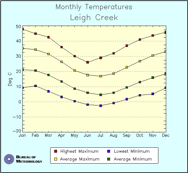
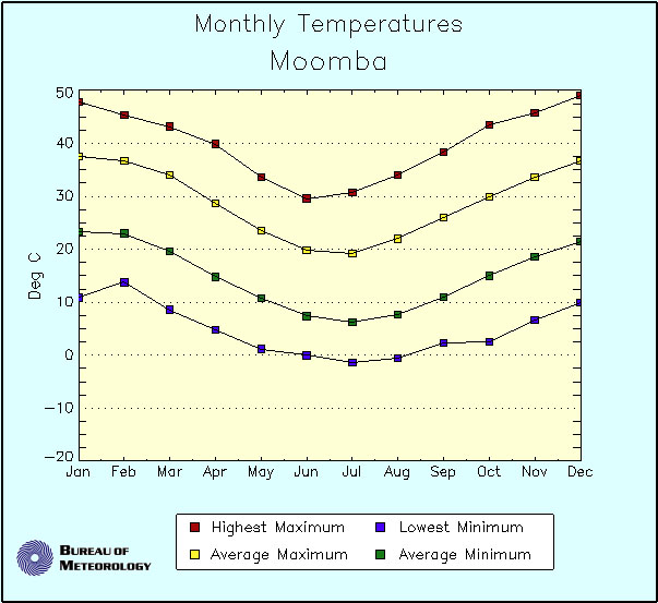
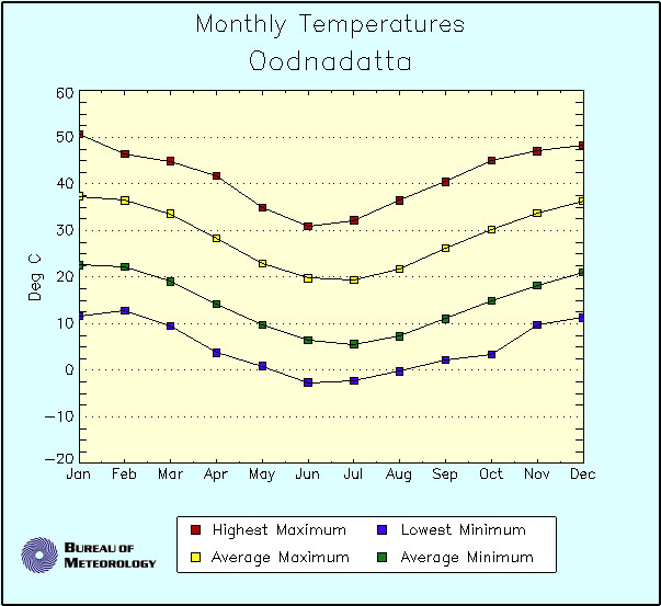
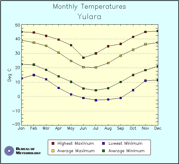
Climate Averages
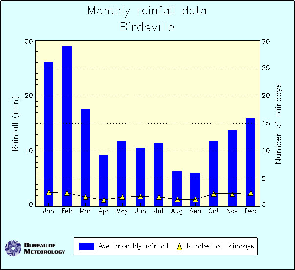
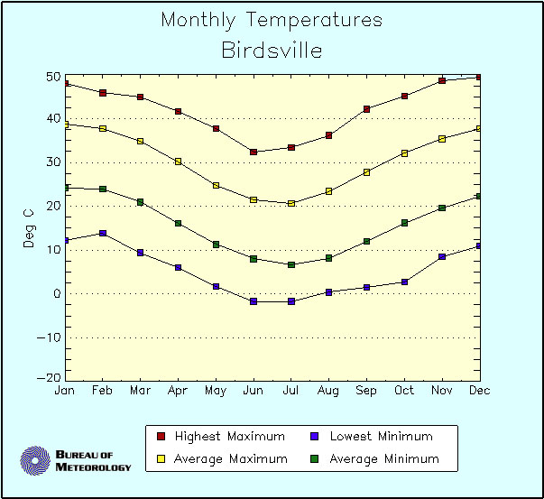
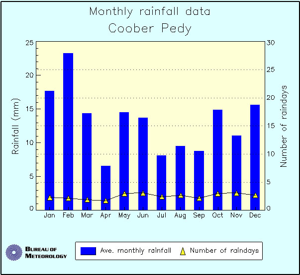
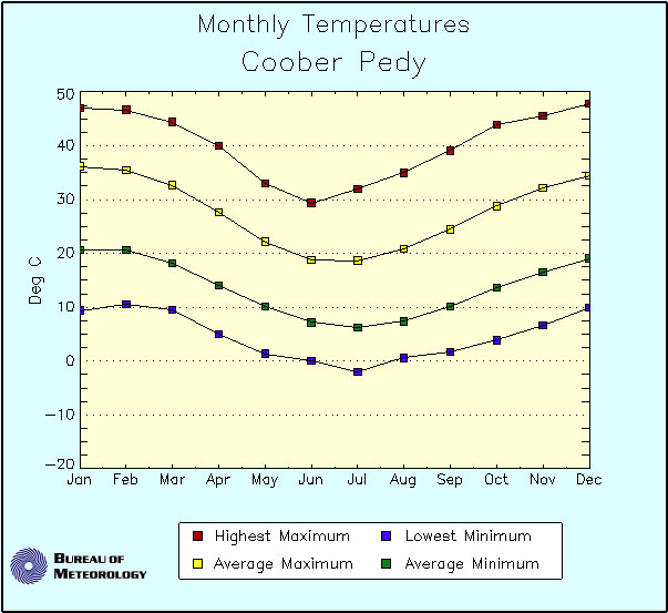
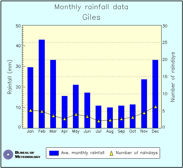
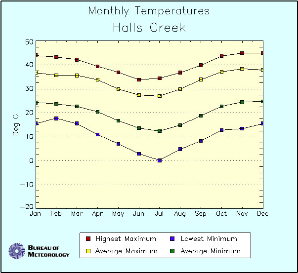
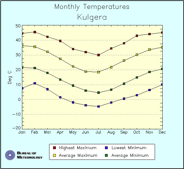
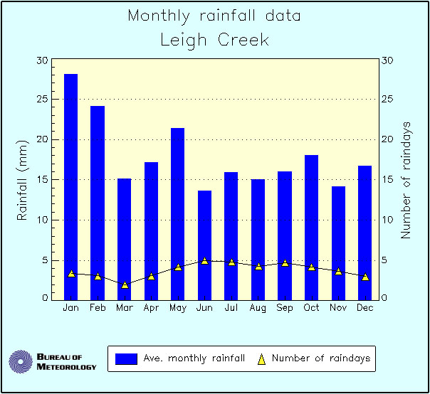
This data has been obtained from the Australian Bureau of
Meteorology (BOM). Further work is needed to acquire more localised climate histories and predictions (3, 6 and 12
months, updated in this document regularly). For example, monthly averages including solar radiation and wind (for
estimation of renewable power potential) and relative humidity (relevant for analogue suit operations, for example) may
be useful. In addition, typical daily weather profiles during various months would be useful for operations planning.
Climate Overview
This section should be expanded to provide a detailed climatic overview with a focus on central Australia.
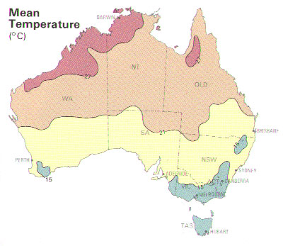
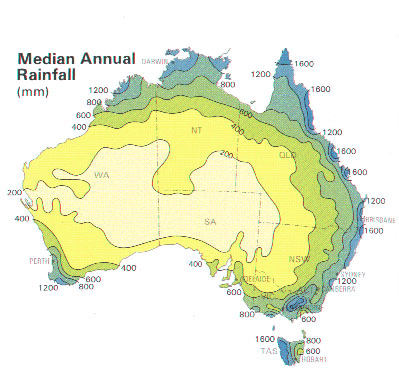
Mean Temperature and Median Annual Rainfall for the Australian Continent (click to enlarge).
|
|
The driest part of Australia is Lake Eyre (adjacent to the Sturt Stony Desert) with an average rainfall of around 140 mm per annum and less than 30 rain days annually on average.
Climate Averages
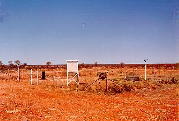
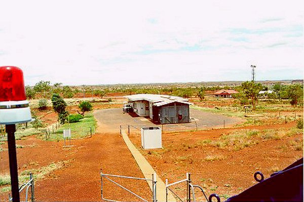
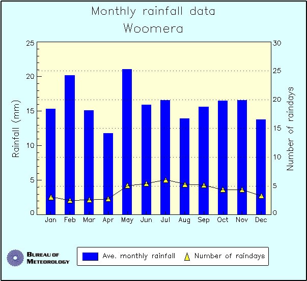
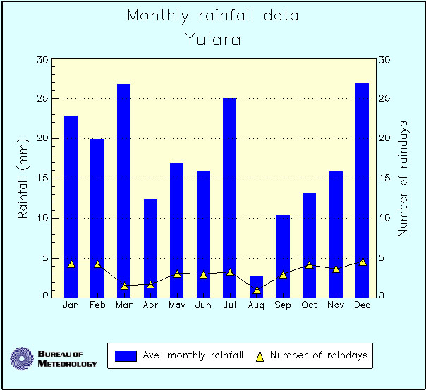
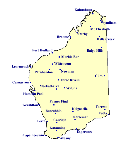
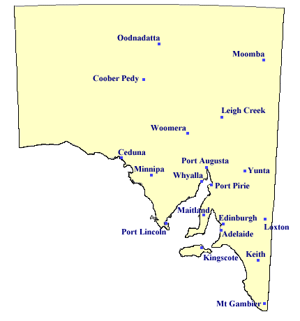
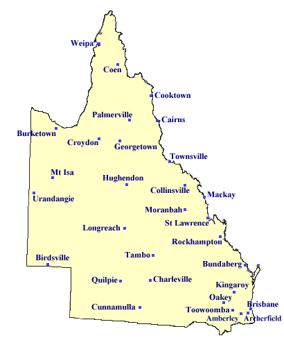
Australian weather stations collect data at least daily, and BOM provides averages for a range of parameters. The Queensland Department of Natural Resources provides interpolation of climate averages for locations between stations (navigate to SILO website).
BOM Weather Stations in four States (click to enlarge).
|

|
|
|
